


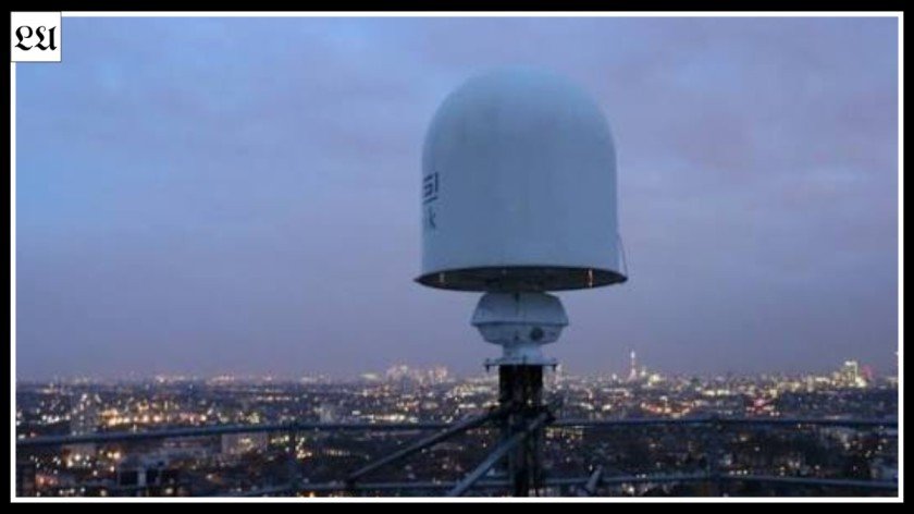
The London weather can be unpredictable, whereby sunlight, clouds, and rain showers can come up quickly. Therefore, accurate weather data becomes important to commuters, tourists, cyclists, walkers, and people planning any outdoor activity. London weather radar becomes useful in monitoring rain by depicting the development of rain and its movement in the London city. The radar system becomes more useful compared to the forecast in terms of monitoring rainfall since a forecast is mainly concerned about the anticipated weather conditions. The radar becomes more useful when combined with other data sources such as hour by hour weather predictions and weather warning messages.
London Weather Radar Live: How to Track Rain in Real Time
A london weather radar live search usually means that someone wants to see the latest available precipitation information rather than only reading a general forecast. Weather radar uses electromagnetic signals to detect particles associated with precipitation in the atmosphere. The returned signals are processed and converted into visual information that can be displayed on a map. Different colours generally represent different precipitation intensities, although the exact colour scale depends on the service. The map may cover London and a much wider surrounding area, allowing users to see where rainfall is developing outside the city as well as within it. This wider view is useful because approaching showers can often be identified before they reach central London.
The animation is one of the most useful parts of a radar display. Instead of looking at a single frame, you can watch several observations in sequence and identify the direction in which precipitation is moving. A rain area moving towards London may indicate that wetter conditions are becoming more likely, while a system moving away may suggest improving conditions. However, movement is not always perfectly predictable. Showers can weaken, strengthen, split apart or develop in new locations. This means that radar should be interpreted as evidence about a weather trend rather than a guaranteed timetable. Looking at several frames is generally much more informative than looking at one isolated image.
The word “live” can also be misunderstood. Weather radar is not normally updated every second, because observations have to be collected, processed and displayed. There can therefore be a short delay between atmospheric conditions and what appears on your screen. This is not usually a major problem for everyday planning, but it matters when you are trying to make extremely precise predictions. Before using a radar map, check the timestamp and legend. A recent image combined with an animation gives you a much better understanding of the current rainfall situation than an old or unexplained screenshot.
London Weather Radar Hourly: Combining Radar With Forecast Information
A london weather radar hourly search is useful because many people want both current precipitation information and an estimate of what will happen during specific hours. An hourly forecast provides predicted conditions for different periods of the day, including factors such as temperature, rainfall probability and wind. Radar provides a different type of information by showing observed precipitation and its recent movement. These tools should therefore not be viewed as competitors. They answer different questions and become more useful when used together. The forecast helps you organise your day, while radar can help you adjust your plans as the weather approaches.
Imagine that your forecast says showers are possible between 2pm and 5pm. Early in the morning, there may be no useful radar information about exactly where those showers will form later. As the afternoon approaches, however, radar can show whether precipitation is already developing nearby. You might see a rain band moving towards your area, or you might discover that showers are concentrated elsewhere. This additional information can help you decide when to leave home or whether to take waterproof clothing. It does not eliminate uncertainty, but it provides a more detailed picture than relying only on a percentage in a forecast.
Hourly information is especially useful for people whose plans depend on timing. A commuter may want to avoid a particularly wet period, while a tourist may want to visit an outdoor attraction during a temporary dry spell. A cyclist may check conditions before setting off, and a photographer may wait for a shower to pass before heading outdoors. For these situations, it makes sense to start with the hourly forecast and then check recent radar information shortly before the activity. Always consider other weather factors as well, because rainfall is only one part of the conditions you may experience.
London Weather Radar Satellite: Understanding the Difference
The phrase london weather radar satellite refers to two related but different types of weather observation. Radar is mainly concerned with precipitation, while satellite imagery provides a broad view of clouds and atmospheric systems. This difference is important because a cloudy sky does not necessarily mean that heavy rain is falling. Similarly, an area producing rainfall may be easier to identify on radar than on a satellite image. Understanding the purpose of each technology helps you choose the right information. If your immediate question is whether rain is approaching your neighbourhood, radar is generally more directly relevant. If you want to understand the larger weather pattern, satellite imagery can provide valuable context.
Satellite images can show cloud systems covering very large areas, sometimes extending well beyond the UK. They can help explain why London is becoming increasingly cloudy or how a large weather system is moving towards southern England. During daylight, visible satellite imagery can show reflected sunlight from clouds and the Earth’s surface. Other satellite products can provide information that is not dependent on visible light. However, the interpretation can be more complicated than simply looking at a rainfall map. Clouds have different structures and thicknesses, and not every visible cloud produces significant precipitation at ground level.
Using radar and satellite information together can therefore provide a fuller understanding of changing conditions. For example, a satellite image might show a broad cloud system approaching the south of England, while radar reveals that the most active rainfall is concentrated within certain parts of that system. This distinction can be useful when planning a journey or outdoor activity. You can use satellite information to understand the wider situation and radar to focus on precipitation. Neither source should be treated as a perfect forecast. Instead, they provide different pieces of information that become more useful when interpreted together with official forecasts.
London Weather Radar Tomorrow: Planning Ahead With Better Information
A london weather radar tomorrow search needs some clarification because current radar observations cannot directly tell you exactly what tomorrow’s rainfall will be. Radar mainly shows precipitation that is currently occurring or has recently occurred. That precipitation may move away, weaken or disappear before tomorrow. New showers can also develop that are not present on today’s map. For this reason, a weather forecast is more appropriate when you are planning a day in advance. Forecasts use atmospheric observations and weather models to estimate future conditions. Radar becomes more useful closer to the actual time when precipitation starts to develop.
Suppose you are planning a sightseeing trip tomorrow. Several days before the trip, you can check the broader forecast to understand the expected temperature, wind and possibility of rain. The evening before, review the latest forecast because weather predictions can change as new information becomes available. On the morning of your trip, check the hourly forecast for the periods that matter most. If rain is expected, recent radar information can then help you understand whether precipitation is approaching. This layered approach allows you to remain flexible instead of cancelling an entire day because the forecast mentions showers.
The same method works for outdoor activities, family plans and travel across London. A forecast several days ahead provides a broad planning picture, while information becomes more specific as the date approaches. On the day itself, radar can be particularly helpful for short-term adjustments. You might move an outdoor activity earlier, delay a walk or choose an indoor attraction while a rain band passes. However, longer-term radar predictions should be treated cautiously. The further into the future you look, the more important it becomes to rely on updated forecasts rather than today’s precipitation pattern.
How Accurate Is Rainfall Radar? Benefits, Limitations and Common Mistakes
Rainfall radar is a valuable weather observation tool, but it is not perfectly precise at street level. Radar detects precipitation in the atmosphere rather than directly measuring every drop that reaches a particular pavement or garden. Atmospheric conditions can influence what the radar detects, and precipitation can change while moving towards the ground. There can therefore be occasions when the map suggests rain nearby but conditions at your exact location remain dry. This does not necessarily mean the radar is “wrong”. It means the observation needs to be understood in its proper context.
Small showers can be particularly difficult to track. A shower may develop quickly, weaken, split into separate areas or disappear before reaching the expected location. This is why watching radar animation is usually more useful than relying on one frame. The timestamp is also important because there may be a delay between observation and display. Colour scales can also vary between weather services, so users should check the legend rather than assuming that a particular colour always represents the same rainfall rate. These small details can significantly improve the way you interpret the map.
There are still many important benefits. Radar provides a visual representation of precipitation, supports short-term planning and can help users understand why rainfall differs between London neighbourhoods. It is particularly useful for commuters, cyclists, walkers, runners, tourists and outdoor event organisers. However, there are limitations. Radar cannot guarantee rainfall at a specific address, is less useful for long-range predictions and should not replace official severe-weather warnings. If strong winds, thunderstorms or flooding are possible, you should consider the complete weather situation rather than focusing only on the rain map.
Why People Use London Rain Radar for Travel and Outdoor Activities
One of the biggest reasons people use rain radar is convenience. London journeys often involve walking between stations, waiting for buses, changing trains or crossing large areas of the city. A short but heavy shower can make part of a journey much less comfortable. By checking precipitation information before leaving, travellers can sometimes make small adjustments that improve the experience. Someone may decide to wait a few minutes, take waterproof clothing or change the timing of a walking section. These decisions do not require perfect weather prediction. They simply require useful information about what is happening nearby.
Cyclists and runners can also benefit because they are directly exposed to changing weather conditions. A rain band approaching a planned route may encourage someone to delay the start or choose a different time. Walkers and tourists can use similar information when planning visits to parks, outdoor landmarks and open spaces. Photographers may even use changing weather to their advantage, waiting for particular conditions or planning around periods of rain. Families can also use precipitation information when deciding when to visit a playground, park or outdoor attraction. The value comes from flexibility rather than certainty.
Outdoor event organisers can benefit from monitoring rainfall because weather can influence equipment, guest comfort and scheduling. However, radar should never be the only safety source for a major event. Rainfall is only one part of weather risk, and strong winds, lightning, flooding and other hazards may require additional action. Official warnings and professional safety procedures should always take priority when severe conditions are possible. For ordinary everyday activities, though, a rain map can be a simple and effective planning tool. It helps people understand that a rainy forecast does not necessarily mean that every part of the day will be wet.
Is London Weather Radar Worth Using?
Yes, rainfall radar is worth using when you need short-term information about precipitation. Its biggest advantage is that it provides a visual picture of where rain is located and how it is moving. This can be more useful than a simple statement saying that showers are possible. A commuter can see whether a rain area is approaching, a tourist can adjust an itinerary, and a cyclist can decide whether conditions look suitable for a planned journey. The information is especially valuable on unsettled days when showers are scattered and conditions can change quickly across different parts of London.
The main reasons to use rainfall radar include:
- Tracking approaching showers before leaving home
- Checking rainfall during a London commute
- Planning walking and cycling journeys
- Choosing better times for outdoor activities
- Monitoring changing precipitation during the day
- Understanding rainfall differences across London
It is important, however, to use the technology for the right purpose. Current radar is not a substitute for a forecast several days ahead. If you are planning tomorrow, begin with the latest forecast and use hourly information as the date gets closer. On the day, radar becomes increasingly useful for monitoring actual precipitation. Satellite imagery can add wider information about cloud systems, while official warnings provide essential information when severe weather is possible. Combining these sources is more reliable than expecting one map to answer every weather question.
Frequently Asked Questions
What does a live London rain radar show?
It shows recent rainfall and helps track showers moving across London.
Can radar predict tomorrow’s rain?
Radar is best for current conditions, while forecasts are more suitable for tomorrow.
How often is rainfall radar updated?
Most radar services update their maps regularly, although the exact timing varies between providers.
What is the difference between radar and satellite images?
Radar tracks precipitation, while satellite images mainly show clouds and wider weather systems.
Is London rainfall radar accurate?
It is useful for tracking rain patterns, but small showers can change quickly
Conclusion
Weather conditions in London can be erratic, and thus, having reliable weather updates would be essential for locals, commuters and tourists. London weather radar proves to be an effective method for monitoring rainfall patterns and planning effectively. Live radar can prove to be helpful in determining ongoing showers, whereas hourly forecast would be more helpful for time-sensitive purposes. Satellites would be able to give a broad perspective on clouds and oncoming weather systems. Whereas, forecasts would be helpful for tomorrow’s weather planning. However, though radar does not offer certainty in terms of future weather patterns, when used properly.